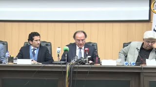
The government has decided to make the Survey of Pakistan into a national mapping agency, according to the draft of a proposed bill. According to the draft bill, the government will detain for at least three months elements damaging the Survey of Pakistan's markings, sources said on Tuesday.
The Survey of Pakistan is a national mapping organisation is responsible for surveying and mapping requirements of the Armed Forces as well as civilian organisations/ departments. Rapid developments in the field of surveying and mapping, especially computer-aided cartography, availability of satellite imagery and satellite-based Global Positioning System (GPS) have greatly facilitated the art of map making.
As a result, a number of firms were engaged in mapping activities. Most of them, being non-professional, were not only producing sub-standard maps, but were also involved in mapping of sensitive areas without any authorisation. If the mushroom growth of such firms was not checked instantly, it would be a potential source of high security risk on the one hand and a decline in mapping standards on the other.
The Ministry of Defence argued that in the absence of any law and regulatory authority, it would be technically and legally difficult to keep a check on the unlawful activities of such unauthorised firms. Australia, China, India, Turkey, the US and the UK have already enacted supportive laws and framed necessary laws to regulate the mapping activities.
The objectives of regulating and implementing surveying and mapping standards was to obviate potential security risk to sensitive information, prevent damage to affixed survey markers, avoid duplication of effort in mapping and to transform the Survey of Pakistan into a National Mapping Agency, a draft of Land Surveying and Mapping Bill-2010 has been prepared by the Survey of Pakistan.
Salient features of the Bill are as follows: (i) transform the Survey of Pakistan into a National Mapping Agency ie an authority regulating surveying and mapping activities in the country; (ii) to make it compulsory for all firms involved in Surveying and Mapping activities to get themselves registered with the Survey of Pakistan; (iii) to make it obligatory for all firms involved in Surveying and Mapping activities to adopt Surveying and Mapping standards framed by the National Mapping Agency, ie the Survey of Pakistan; (iv) to stop unqualified/unregistered firms from taking part in surveying and mapping activities that could pose a security risk to the state; (v) to protect established and affixed survey markers at various locations across the country from damage by assigning their responsibility to local district management/ governments; (vi) to avoid duplication of efforts in the field of mapping especially in the public sector, thereby economising on public exchequer; and (vii) to assess mapping requirements of public and private sectors on a yearly basis, thereby lending technical support to federal and provincial developmental plans and activities.
Offences and penalties will be as follows: (a) any organisation, firm, individual or group of individuals engaged in any unauthorised activity within the meanings of this Act shall render itself a accused of illegal practices and will be asked by Survey of Pakistan to immediately suspend all such activities; (b) Survey of Pakistan shall ask concerned police to register a criminal case on such activities; (c) depending upon nature of such violations, the accused shall be asked by the Survey of Pakistan or its designated official to deposit the entire received money with the department and a penalty up to fifty thousand rupees; and (d) in case Survey of Pakistan is convinced of major offence on the part of the accused then his case shall be referred to a court of law and shall be tried for the following, namely (i) any individual or group causing hindrance and obstruction to the work being done by Survey of Pakistan and a registered surveyor shall be liable to be imprisoned for a term which may extend upto one month and a fine upto Rs 50,000; (ii) any individual or group causing damage to survey mark shall be liable to be imprisoned for a term which may extend upto three months and a fine upto Rs 100,000; (iii) an individual who engages in geospatial data production, analysis and surveying and mapping activities in violation of the provisions of this Act shall be liable to be imprisoned for a term which may extend upto one year and a fine upto a million rupees; (iv) every act of damaging, destroying, removing, seizing, occupying or establishing a mark resembling a permanent survey mark of Survey of Pakistan shall be an offence under this Act, punishable with imprisonment for a term which may extend upto one month and a fine upto Rs 50,000; and (v) the owners, directors or managers whosoever of any accused organisation, firm individual or group of individuals which engages in geospatial data production analysis surveying and mapping activities or any related activities in violation of the provisions of this Act, shall be liable to be imprisoned for a term which may extend up to one year and a fine upto Rs 5 million.
BR100
11,987
Increased By
93.1 (0.78%)
BR30
37,178
Increased By
323.2 (0.88%)
KSE100
111,351
Increased By
927.9 (0.84%)
KSE30
35,039
Increased By
261 (0.75%)


Comments
Comments are closed.